Mapping the Invisible
Hotter is red and colder is blue
Mats Bigert
In 1917, the father of modern meteorology, Wilhem Bjerknes, founded the Bergen school of meteorology in the north of Norway. The school comprised young Scandinavian meteorologists who worked with Bjerknes to untangle the mystery of cyclic storms in the temperate latitudes. Bjerknes’s method of research was based on the idea that mapping and predicting the weather would only be possible with a vast net of observation stations spread out throughout the country.
The war was coming to an end but there was still the threat of a German invasion from the North Sea and the Norwegian fleet had realized the importance of predicting the weather in order to defend the coastline. This provided Bjerknes with arguments to persuade the government to support him with the funds he needed to erect seventy-five weather stations throughout the country. By 1918, he and his team were gathering information from the stations three times a day and compiling it into synoptic maps. These detailed maps gave the best image available of the weather’s behavior, and Bjerknes soon realized that the old theories of how a cyclic storm is fueled by air pressure differences was completely wrong. By studying the maps day by day and tracking the movement of the weather, an image of divided masses of hot and cool air appeared.
This groundbreaking discovery lead to the theory of how hot and cold fronts interact within a cyclic storm. The term “front” was coined as a metaphor for the movement of troops in war, and Bjerknes thought the term captured perfectly the territorial fight between the cold air from the pole and the hot air from the south. Low-pressure cyclic storms engage in the most elaborate battles in this global atmospheric war. The hot front advances upon the cold forces east of the pressure center. This results in rain. Retreating, the cold air moves up and around and launches an enveloping attack upon the western flank of the hot air. This pushes the hot air up and a second bout of aggressive precipitation descends on us.
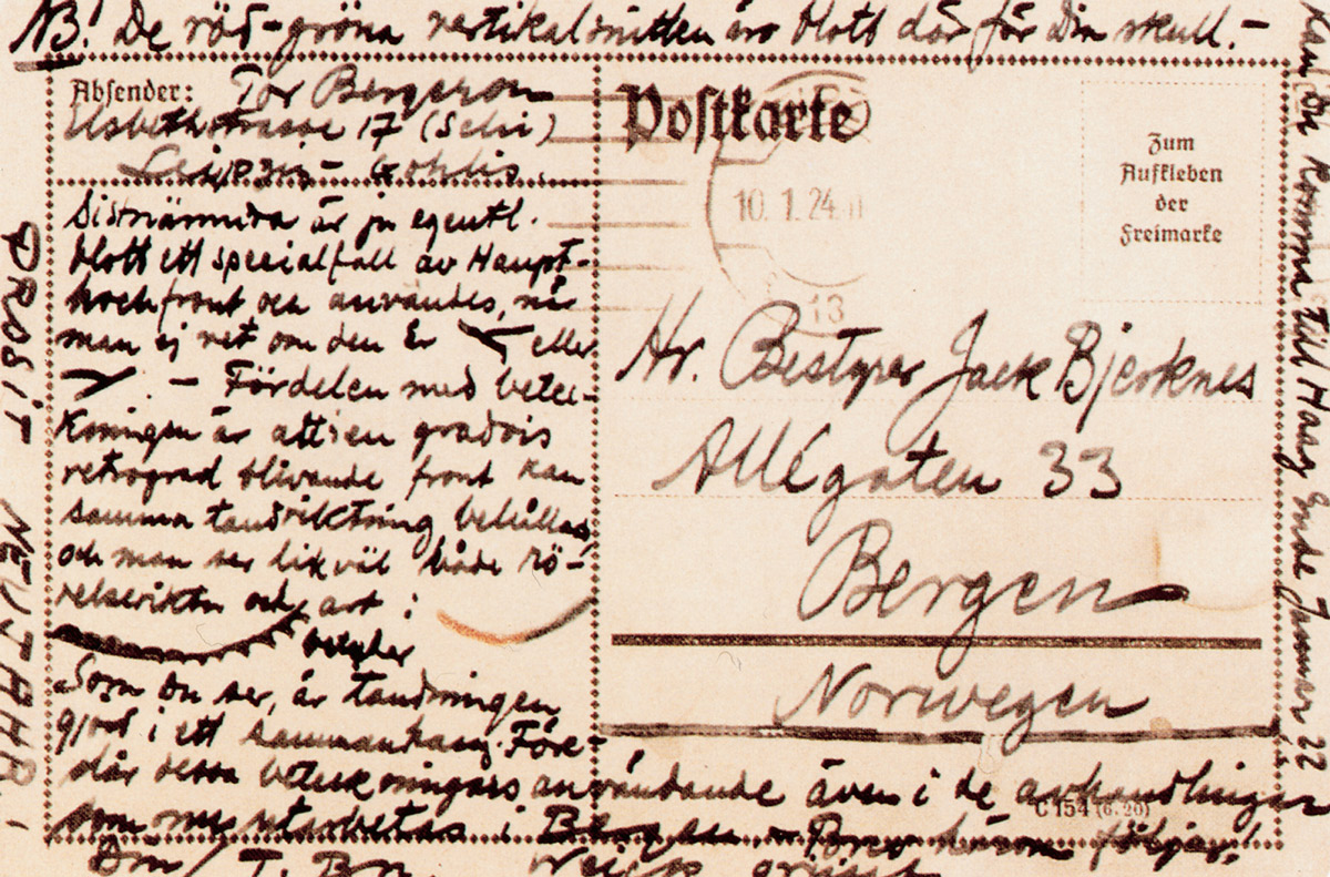
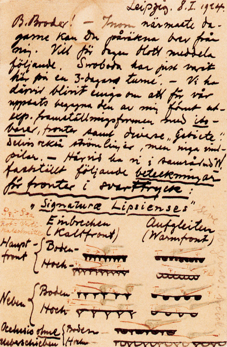
The visual design of the hot and cold front symbols was suggested by Tor Bergeron in 1924. He scribbled down some sketches on a postcard which he sent to Bjerknes in Bergen. Examining the card shows that a first suggestion was erased before Bergeron finally decided on the now familiar blue “thorn” cold front and the red “belly” hot front. Tor Bergeron brilliantly solved the art director’s classic problem of depicting the invisible.
Today the symbols still radiate the militant energy that was first imagined in them. In front of the TV weather forecast, preparing for their vacation, most people can relate to the frozen fear that an approaching cold front causes. Everyone longs for a siege … by the reds.
Mats Bigert is an artist based in Stockholm. He is one half of the art duo Bigert & Bergström. He is also an editor-at-large for Cabinet.
Spotted an error? Email us at corrections at cabinetmagazine dot org.
If you’ve enjoyed the free articles that we offer on our site, please consider subscribing to our nonprofit magazine. You get twelve online issues and unlimited access to all our archives.