D.I.Y. Eye in the Sky
Masters of all we surveil
Andrew Toland
While searching for images of Beirut’s skyline on the internet, I came across three images posted to someone’s Flickr account. I wanted to find out who took them. What was the exact location in Beirut from which they were taken? Exactly what time of the day were they taken? What could be unearthed about the person who took them? Just how far beyond the images could you go?
Step 1
WHAT YOU WILL NEED: One computer, connected to the internet. That is all.
Step 2
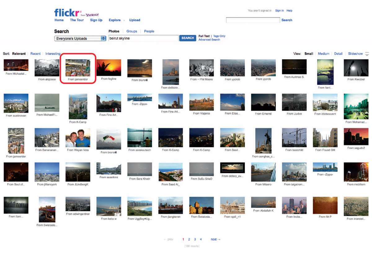
Search for “Beirut skyline” on Flickr (Fig. 1). Select a striking image from the results. Follow the link.
Step 3
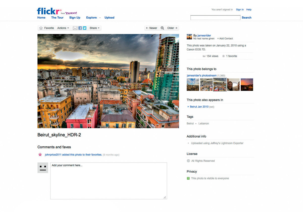
This image was posted to the Flickr account of “jamesrider” (Fig. 2). Jamesrider’s photostream includes a number of other photographs of Beirut’s skyline taken by the same user. Follow those links.
Step 4
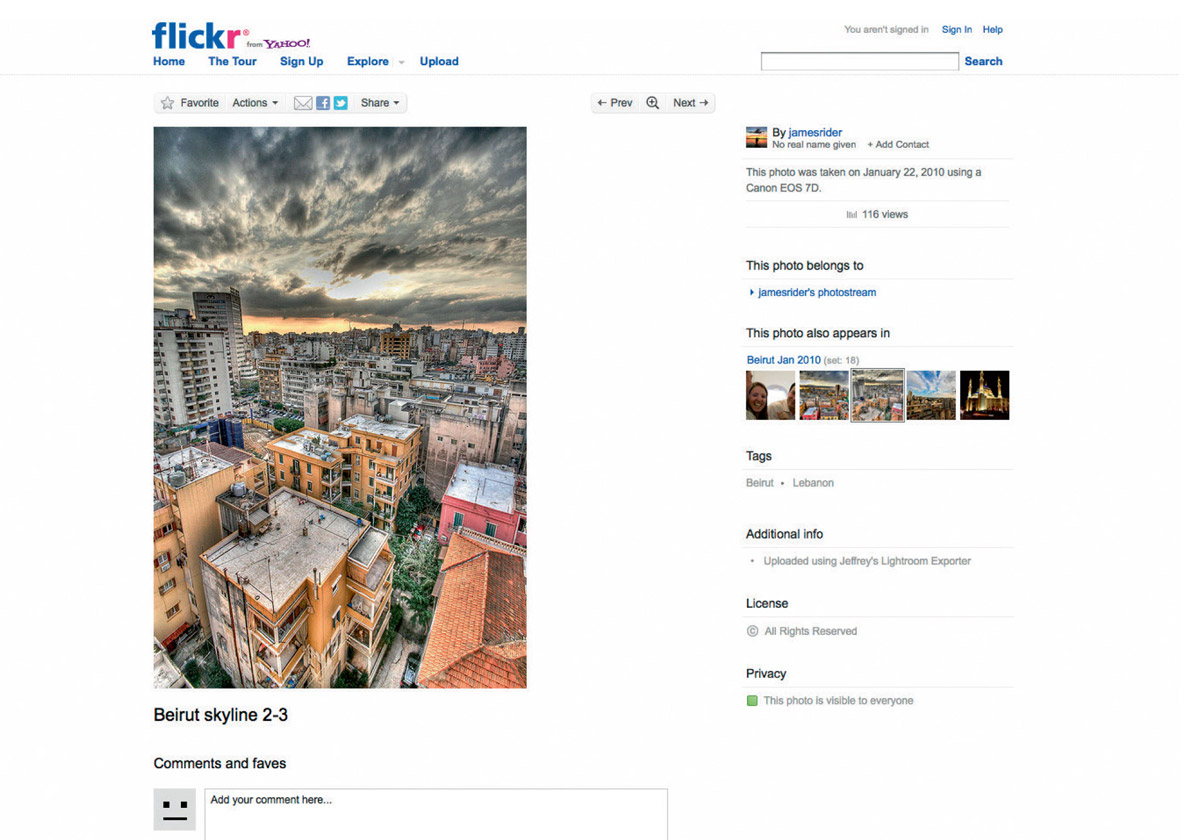
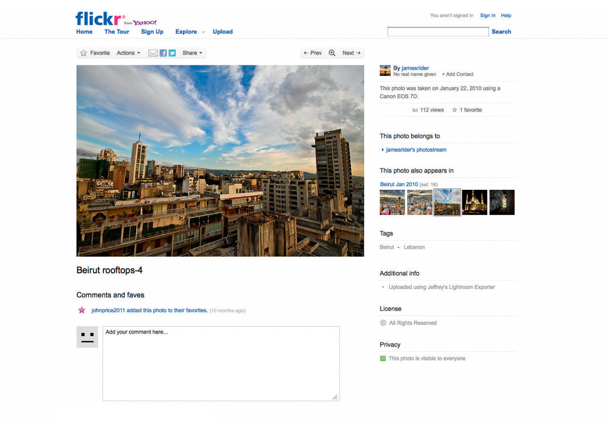
According to each webpage, each of the photographs was “taken on January 22, 2010 using a Canon EOS 7D.” The titles/filenames given to each of the photographs are: “Beirut_skyline_HDR-2” (Fig. 2), “Beirut skyline 2-3” (Fig. 3), and “Beirut rooftops-4”(Fig. 4). For each photograph, click on the photo. Click on “View all sizes.” Click on “Original.” Click on “Download the Original size of this photo.” The photographs can be downloaded at the original resolution at which they were uploaded to Flickr.
Step 5
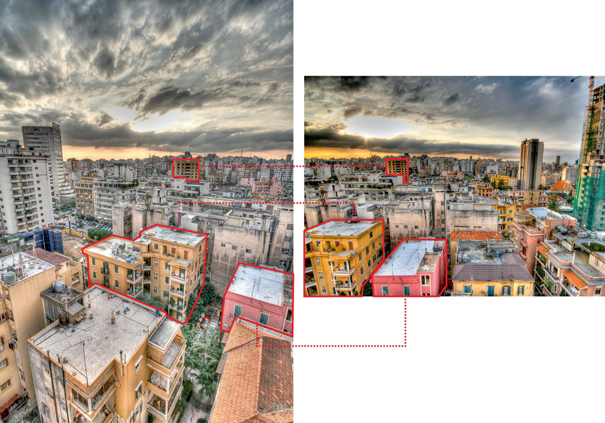
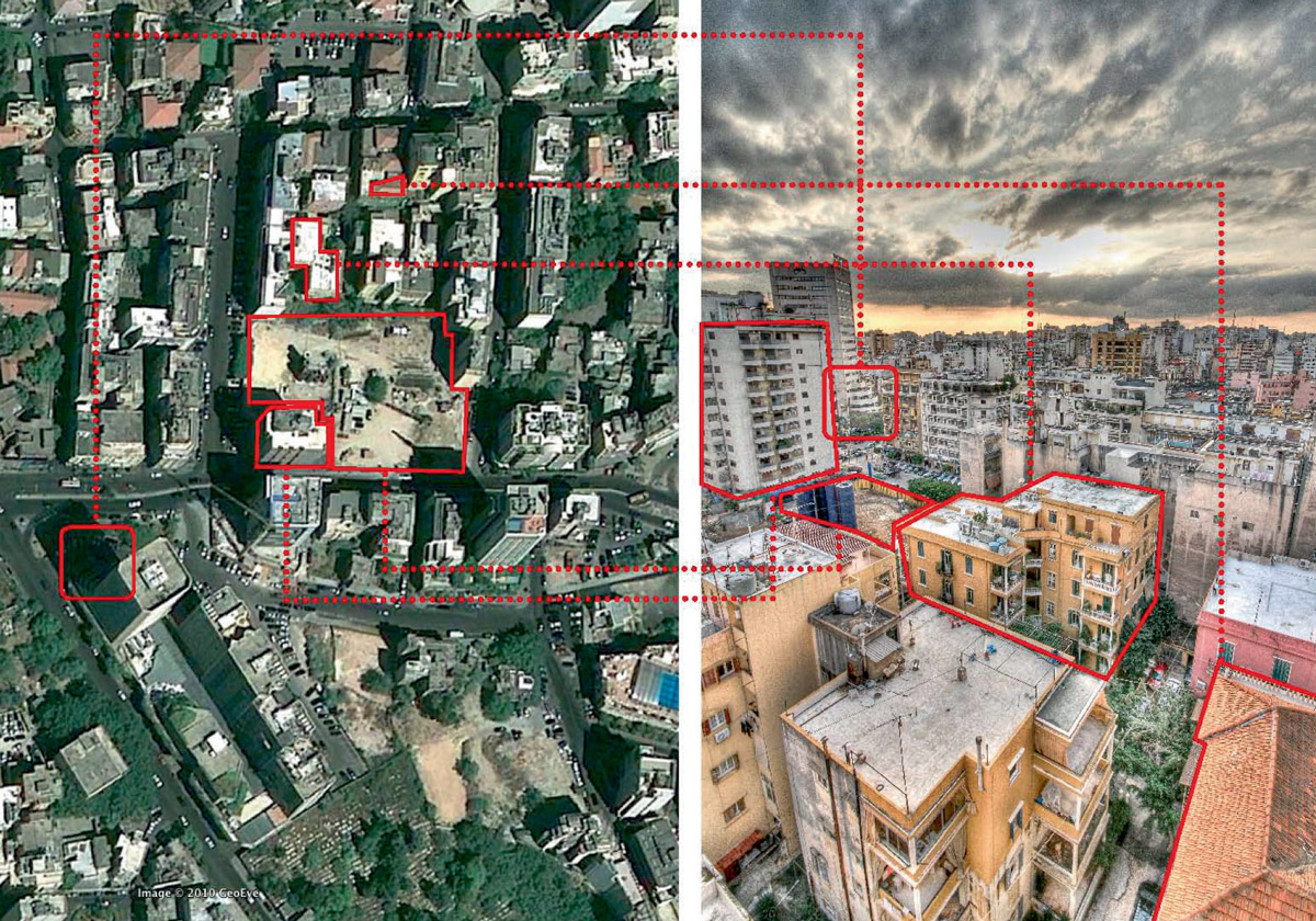
Compare the buildings in each of the photographs (Fig. 5). Notice any overlaps. Note that “Beirut skyline 2-3” and “Beirut_skyline_HDR-2” map onto one another—the former was taken slightly to the left of the latter. “Beirut rooftops-4” is an outlier. It does not appear to share any buildings with the other two photographs.
Step 6
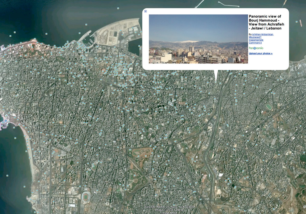
Look up “Beirut” using Google Earth. Turn on “Photos” (Fig. 6). Click on a few. Beirut is a big city (two million inhabitants, eighty square miles). Manually looking for clues in photos that have been associated with specific locations in Google Earth (uploaded to Google’s platform Panoramio) is like looking for a needle in a haystack. This is a dead end.
Step 7
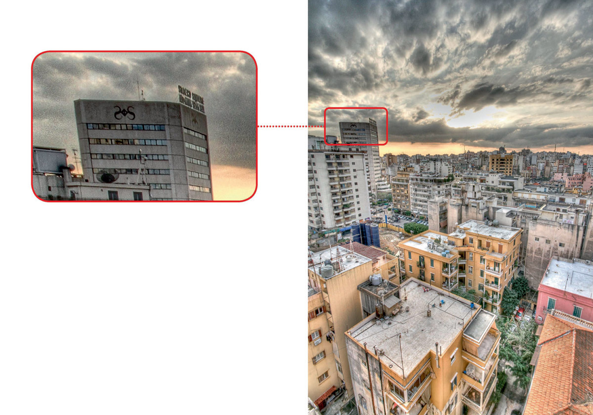
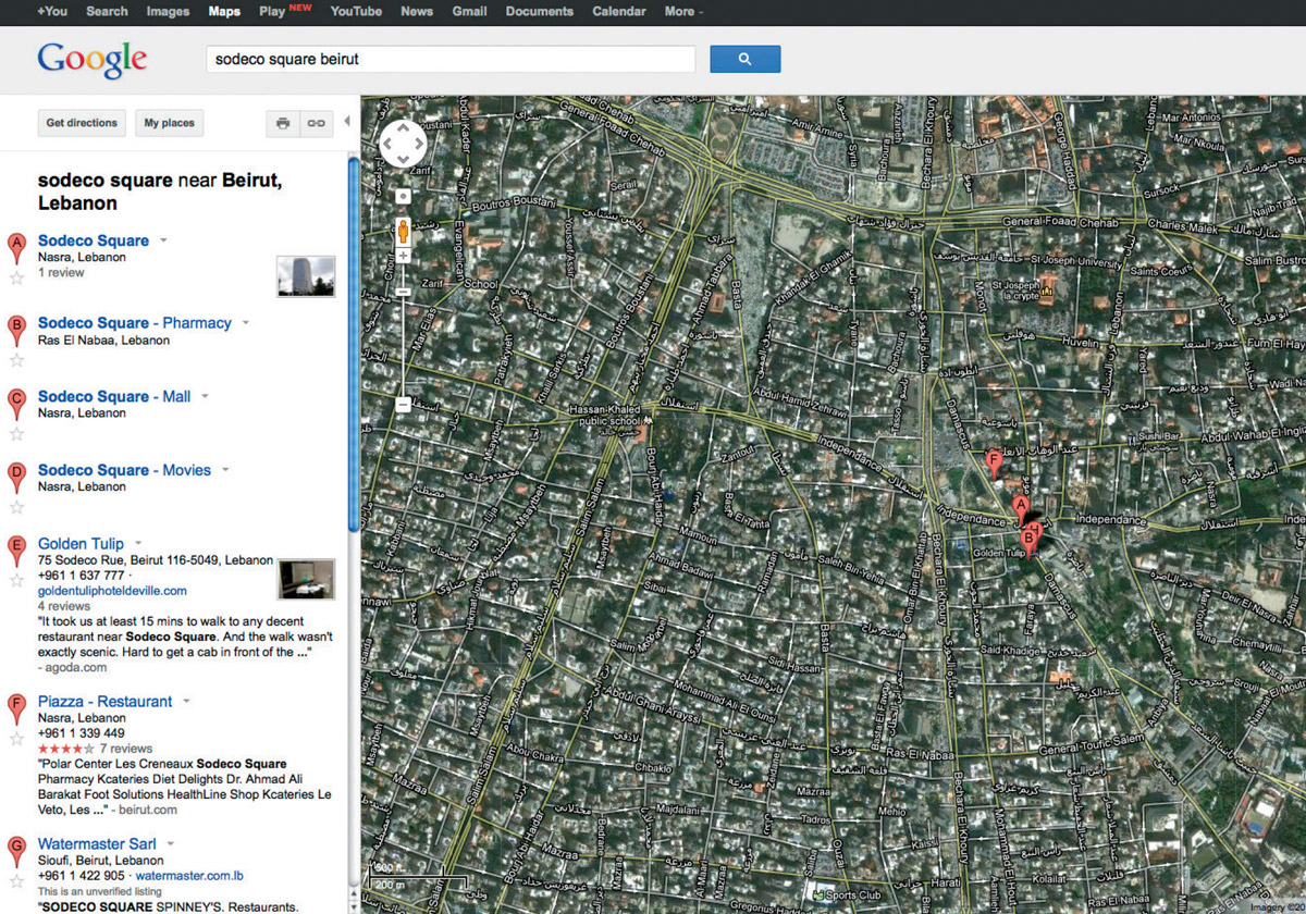
Examine the photographs closely. Look for clues. Your first clue appears in the photograph entitled “Beirut skyline 2-3.” On the top of the tallest building in the left middle ground, there is a sign (Fig. 7). It is at an oblique angle. What does it say? Zoom in as much as possible. “Solero Square”? “Sodero Square”? It’s hard to make out. Ask Google. Google suggests “Sodeco Square, Beirut” instead. Search “Sodeco Square, Beirut” in Google Maps (Fig. 8). Zoom right in. Confirm that in the satellite image there is a high-rise building with chamfered edges and a terraced base.
Step 8
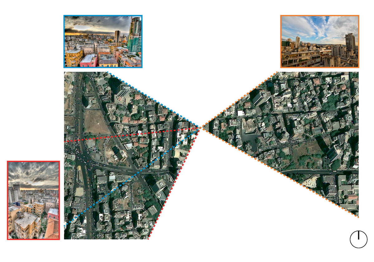
Work out the field of view of each photograph by comparing them to the satellite image in Google Maps: compare the profiles of buildings from above with their appearance from the viewpoint of the camera; identify the taller buildings and open spaces that can serve as landmarks; count the number of buildings between the viewpoint and the landmarks; note where the edges of the frame are in the photograph and which buildings are cropped by them (Fig. 9). Confirm that the fields of view for “Beirut skyline 2-3” and “Beirut_skyline_HDR-2” overlap. Conclude from comparing the satellite image with the photograph that “Beirut rooftops-4” appears to have been taken from roughly the same vantage point, but in the opposite direction of the other two photographs (Fig. 10).
Step 9
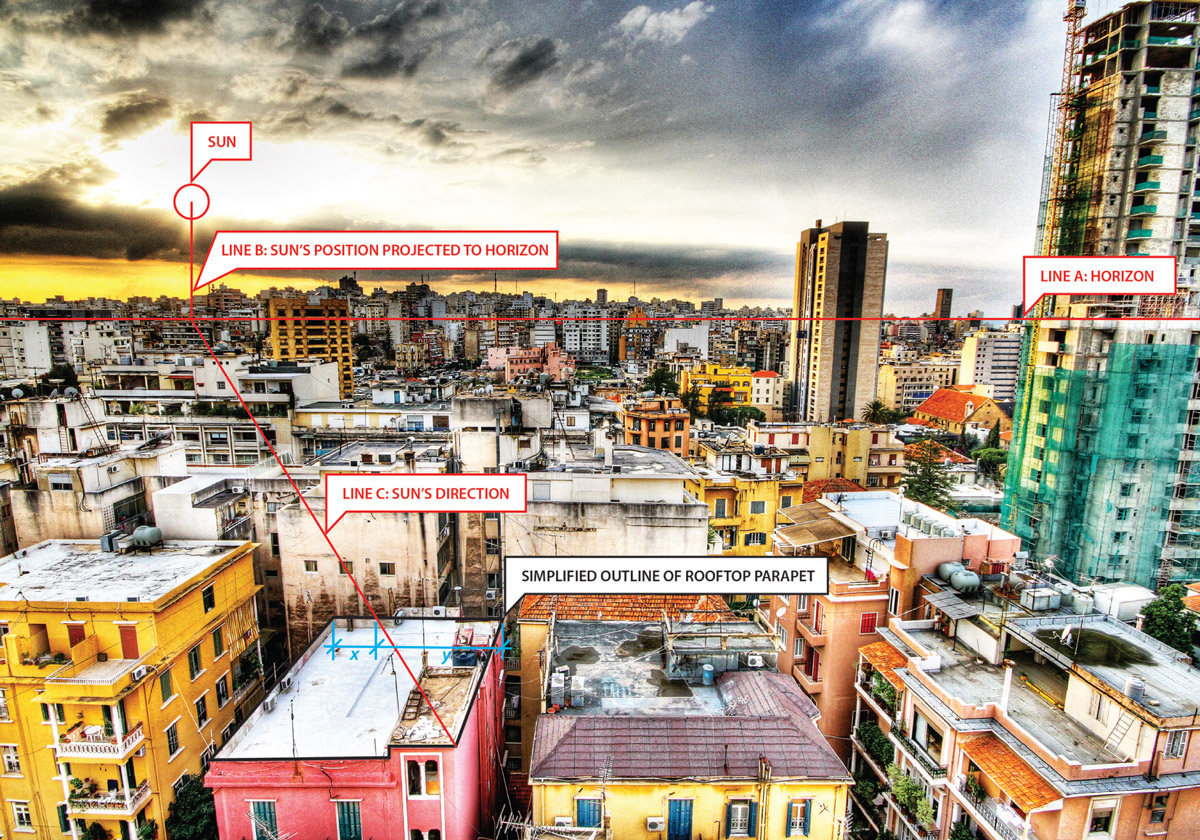
Notice that the sun appears in the top left-hand quadrant of ‘Beirut_skyline_HDR-2’ (helpfully, the sunburst of rays radiating through the clouds allows you to fix its precise location in the image) (Fig. 11). Construct a notional line (Line A) where the horizon would be (helpfully, a sliver of sea is visible in the top right-hand quadrant of the image). Project another line (Line B) from the location of the sun down to the horizon, then project a third line (Line C) from this point on the horizon to the back right-hand corner of the roof parapet of the pink building in the foreground. Also note where Line C cuts the roof parapet on the far side of the building.
Step 10
Remap Line C from the photograph onto the satellite image by connecting the back right-hand (northeast) corner of the building in the photograph to the point on the opposite side of the building where it cuts the parapet (Fig. 12). Project a line from the north-east corner of the building in the direction of true north in the satellite image (Line D). Google Earth uses a variant of the Mercator projection for its map images and has grid lines for latitude and longitude that can be toggled on and off, but for our purposes here, true north can be assumed to be directly vertical up the screen. Measure the angle between the two lines. The angle gives the azimuth of the sun (the horizontal angle between north and the position of the sun around the circular horizontal plane of the horizon surrounding a reference point) at the time the photograph was taken.
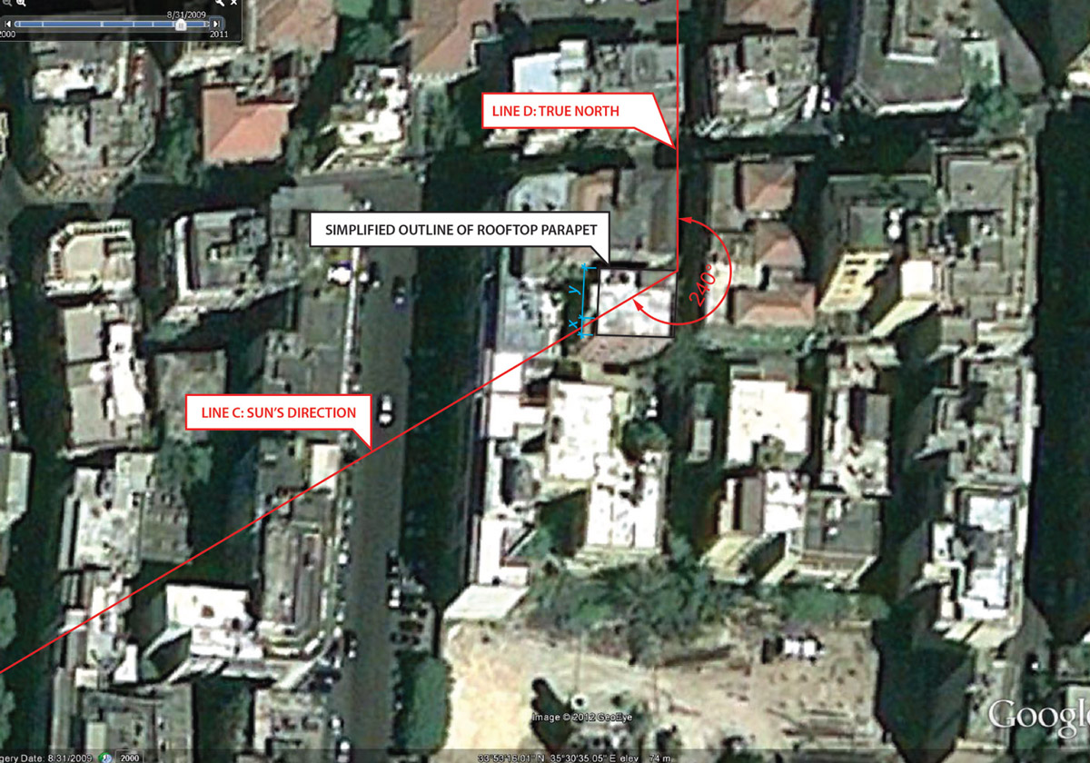
Step 11
Use Google Earth to work out the precise latitude and longitude of the viewpoint of the photographer (shown in Fig. 12). Note that this is 33°53’ N and 35°30’ E (33.88N and 35.50E respectively in decimal notation). Use a sun position calculator (like ). Enter the latitude, longitude, and the date; adjust the time zone so that it uses the correct time zone for Beirut (GMT+2). Compare the azimuths listed in the sun position chart to the azimuth calculated in Step 10. The result is the time at which the photograph was taken: around 4:15 pm.
Step 12
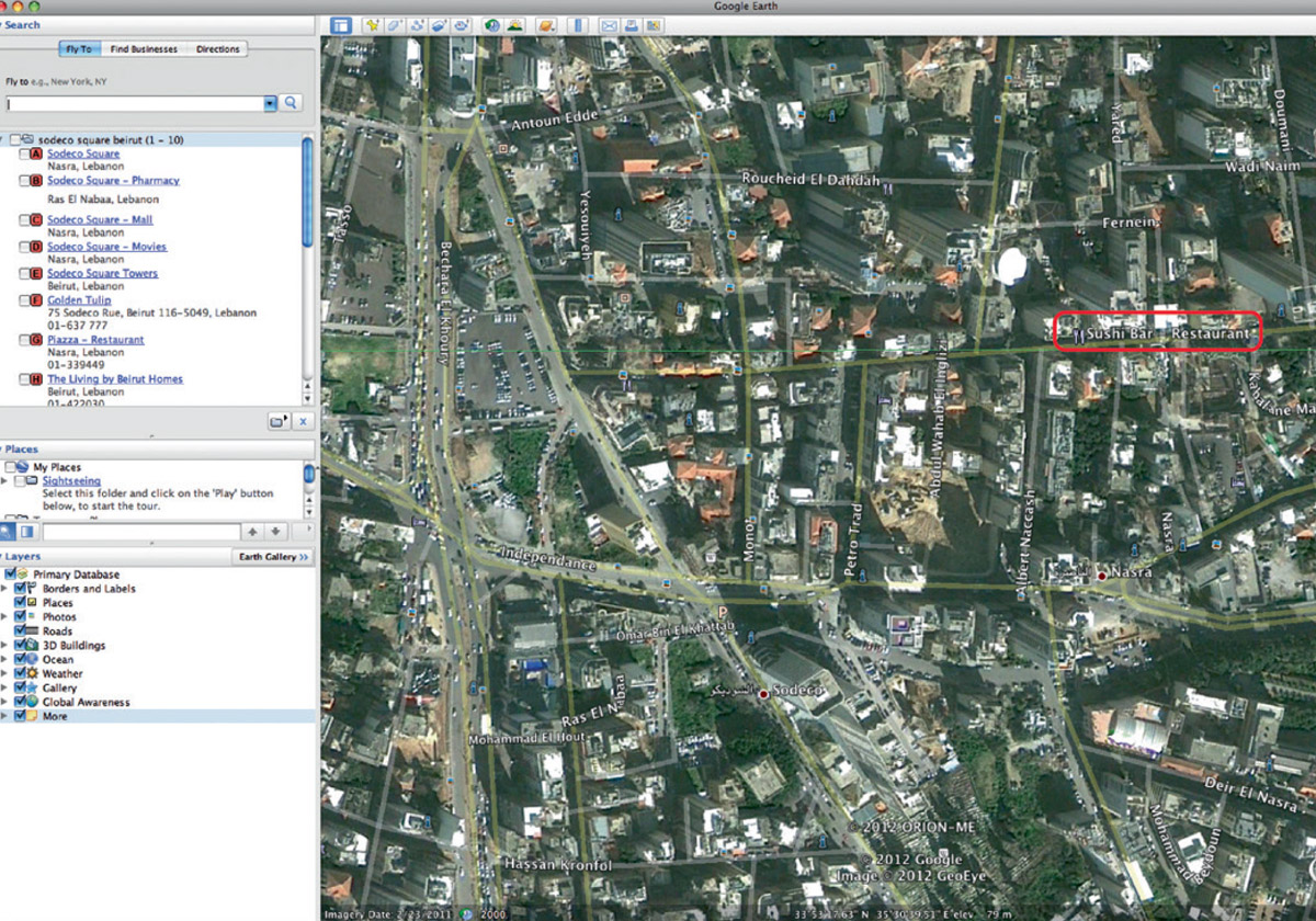
Where were the photographs taken? Compare the viewpoint mapped onto the satellite image from the three photographs (Fig. 9) with the original satellite images from Google Earth and Google Maps. Note from Google Maps that the street where the building from which the photographs were taken is called Abdel Wahab El Inglizi. Turn on all “Layers” in the Google Earth sidebar to load as much additional information into the map as possible. You are trying to uncover the street address of the building from which you think the photographs were taken. Note that Google Earth displays a nearby restaurant called “Sushi Bar” (Fig. 13).
Step 13
Google “‘Sushi Bar’ Beirut.” Follow the link to the first result: “Le Sushi Bar—Official Website.” On Le Sushi Bar’s website, note that it describes itself as being on Monot Street. Try to find out more about the area around Monot Street by Googling “Monot Street Beirut.” Follow the link for the first result: “Beirut/Ashrafieh—Wikitravel.” Note that at the bottom of this page there is a reference to the five-star Hotel Albergo, the address of which is given as 137, Abdel Wahab El Inglizi Street. Could this be it? Based on the images posted to his Flickr account, the photographer appears to have been a tourist visiting Beirut. If so, he (given his Flickr username, you assume that his name might actually be James Rider, even though his profile states “No real name given”) must have either been staying in a hotel or staying in a friend’s apartment. From the surrounding context, the photograph appears to have been taken from the middle of a residential area. You Google “Hotel Albergo Beirut” and you look it up on Google Maps. The website for the Hotel Albergo, although it confirms the address, does not have a map that confirms its exact location. It does, however, contain photographs of the exterior of the hotel and of the rooftop bar and terrace. Could the photographs have been taken from this rooftop bar?
Step 14
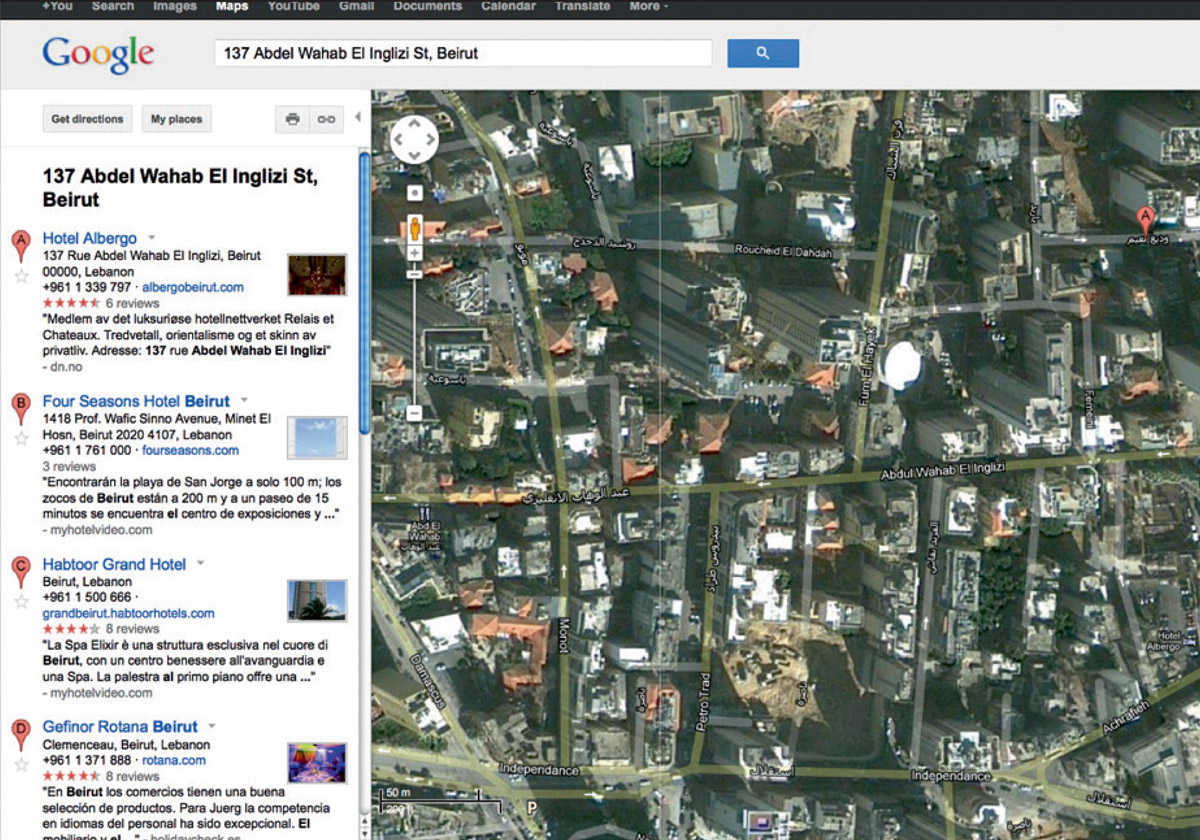
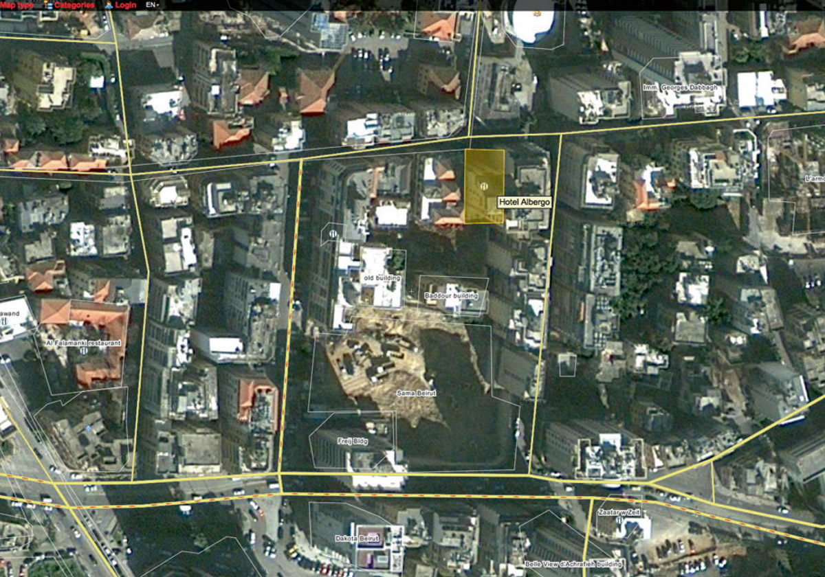
Look up “Hotel Albergo Beirut” on Google Maps. Although the address given in the sidebar is correct (there it is—137 rue Abdel Wahab El Inglizi Street [sic], the A placemarker is not on Abdel Wahab El Inglizi, but is instead on Wadi Naim. This seems a bit odd. You search Google Maps for the address, “137 Abdel Wahab El Inglizi Street, Beirut” instead. Now the placemarker does appear on Abdel Wahab El Inglizi Street, but it is not at the location from which the photograph was taken (Fig. 14). It is a little further east and on the opposite side of the street. Earlier, your Google search for “Monot Street Beirut” also brought up a result for “Beirut City, Monot Street—Wikimapia.” You happened to follow this link as well. Just to double-check on the conflicting results being produced by Google Maps, you search for “Hotel Albergo Beirut” on Wikimapia (Fig. 15). This produces a result that puts a crosshairs exactly where you think the photographs were taken. How to resolve this conflict between Google Maps and Wikimapia and confirm the true location of the Hotel Albergo?
Step 15
You email the Hotel Albergo with screenshots of the results from both Google Maps and Wikimapia. You wait with bated breath, and the following day you get a reply. “We would like to thank you for your email. Further to your request, please note that the exact location of the Hotel Albergo is on the first screenshot (wikimapia). Hoping the above will meet with your request.” Your hunch is confirmed. It seems likely that jamesrider took the three photographs around 4 pm on 22 January 2010 from the rooftop terrace of the Hotel Albergo in Beirut.
Step 16
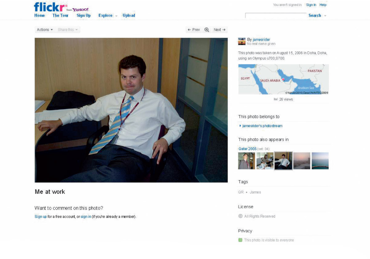
Who is jamesrider? Or rather who is James Rider? From the photographs posted to his Flickr account, it appears that jamesrider is British. Some of his Flickr pages have a link to his website, www.jamesrider.co.uk, which is entitled “James Rider Fine Art Photography” and describes him as “an award-winning photographer based in London, specialising in visually stunning landscapes and iconic landmarks.” Look at other sets in jamesrider’s Flickr account. There is a set entitled “Oxford (Cambridge) Reunion.” There is also a set called “Qatar 2006,” and, within that, a photograph entitled “Me at work” (Fig. 16). Around his neck he is wearing a maroon lanyard with a security tag. In adjacent photographs of work colleagues, the text on the lanyard is more legible. It reads “Qatar Airways.” The first photo in the “Beirut Jan 2010” set is captioned “QR team trip.” A quick Google reveals that QR is the airline code for Qatar Airways.
Step 17
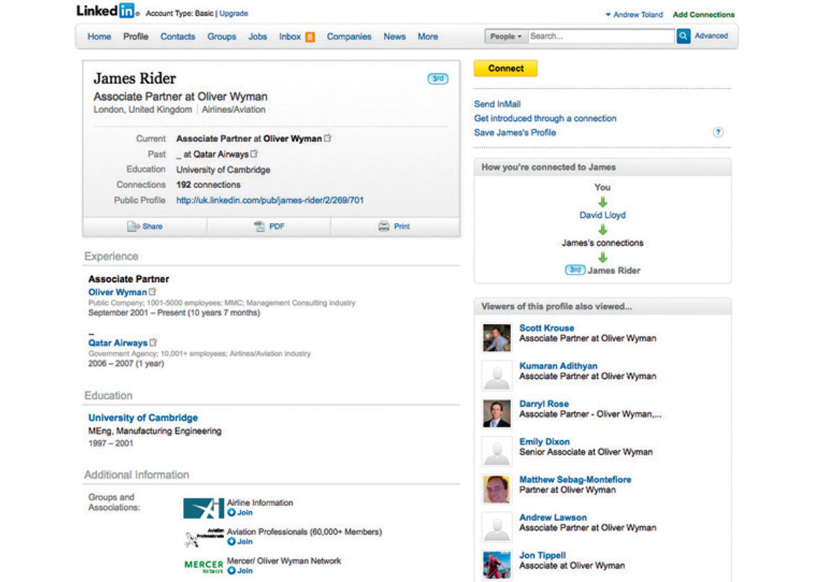
Google “James Rider.” The second result is a link to all the profiles for people named “James Rider” on LinkedIn. The fourth result is for a James Rider based in London, educated at the University of Cambridge where he studied Manufacturing Engineering from 1997 to 2001 (Fig. 17). He is now listed as an associate partner at Oliver Wyman, a management consultancy. His area of specialty is airlines/aviation. Rider has been employed by Oliver Wyman from 2001 to present. Included in his list of experience from 2006 to 2007 is a secondment to Qatar Airways. It would appear from the January 2010 trip to Beirut with the “QR team” that Rider continued to provide consultancy services to Qatar Airways after his secondment.
Step 18
Email James Rider. Email him both at his Oliver Wyman email address and his jamesrider.co.uk one. Confirm that he is one and the same person. Ask him to confirm the time and location of the photographs. Thank him for his time.
Postscript 1
You will hear back from James Rider in due course. He will describe you as “at first alarming” and then “funny.” He will also confirm that he took the photos from the terrace of the rooftop restaurant of the Hotel Albergo.
Postscript 2
After going to all this trouble, you will discover that if you download the original files of the photographs from Flickr and view them using Adobe Bridge software, you can view the original file data for the image (including the camera data). This reveals that the timestamp on the file was 2:14:23 pm on 22 January 2010. Your calculations are either wrong by two hours, or James Rider did not adjust the date and time settings on his camera to reflect the local time in Beirut (it would still have been 2:14:23 pm in London).
Andrew Toland is a research assistant in the division of landscape architecture at the University of Hong Kong. He holds degrees in architecture, law, and economics. He recently completed an architectural installation for “Urban Play,” a public art exhibition held in Beijing’s central business district.