Summer 2005
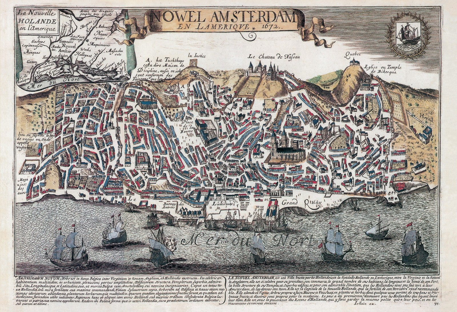
Postcard / A Slight Mismap
Wish this was here
Tal Schori
Tal Schori is the manager of Storefront for Art and Architecture and a former editorial assistant at Cabinet. He lives in Brooklyn.
Spotted an error? Email us at corrections at cabinetmagazine dot org.
If you’ve enjoyed the free articles that we offer on our site, please consider subscribing to our nonprofit magazine, which includes unlimited access to all our archives.